




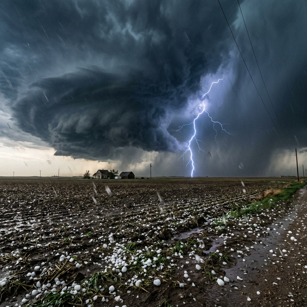
Major Storm System Targets the Midwest
A dangerous and fast-moving severe weather system is sweeping across the American Midwest this week, prompting urgent warnings from the National Weather Service and the Storm Prediction Center (SPC). Residents across Michigan, Illinois, Indiana, Iowa, Wisconsin, and Ohio are being urged to take shelter and prepare for one of the most potent April storm systems in recent memory.
The SPC has issued Slight to Enhanced Risk outlooks for large swaths of the Midwest, with the most dangerous window expected during the afternoon and evening hours — when daytime heating maximizes atmospheric instability and increases the likelihood of severe storm development.
Golf Ball-Sized Hail Is the Headline Threat
Meteorologists are warning that hailstones the size of golf balls — approximately 1.75 inches in diameter — could fall across affected regions, capable of causing severe damage to vehicles, property, crops, and infrastructure. The SPC has flagged a medium-to-high potential for hail exceeding 2 inches in diameter in some of the most at-risk corridors.
"Hail of this magnitude is one of the most underestimated weather hazards," said a National Weather Service meteorologist. "A single storm cell can drop baseball-sized hail with virtually no warning. Anyone caught outdoors during these storms is at serious risk."
"Golf ball-sized hail can shatter windshields, puncture rooftops, destroy crops, and injure or kill livestock and people caught in the open. This is not a storm to take lightly."
Residents are being advised to:
- Move vehicles into garages or covered structures immediately
- Avoid driving during active storm warnings
- Stay away from windows during the storm
- Protect pets and bring livestock to shelter
60 MPH Winds and Tornado Threat
In addition to large hail, damaging straight-line winds of up to 60 miles per hour are forecast, powerful enough to topple trees, damage roofs, and knock out power lines across wide areas. Isolated tornadoes cannot be ruled out, particularly during the peak storm window of Tuesday afternoon and evening.
The primary threat zone stretches along a line from central Iowa down through northern Illinois, northern Indiana, and across southern Michigan — including the heavily populated I-94, I-96, and I-75 highway corridors. Commuters and travelers in these regions are being urged to avoid unnecessary travel during storm windows.
Cities Most at Risk
According to the Storm Prediction Center's outlooks, the following cities face the highest exposure to severe weather this week:
- Detroit, MI — Hail, damaging winds, isolated tornado risk
- Chicago, IL — Large hail, wind gusts, flash flooding possible
- Indianapolis, IN — Tornado watch possible, large hail
- Des Moines, IA — Hail, wind damage, storm surge
- Columbus, OH — Expanding storm risk as system moves east
- Milwaukee, WI — Hail and damaging winds Tuesday
Flash Flooding Also a Concern
The Weather Prediction Center has also flagged the potential for flash flooding along a stationary boundary across the Great Lakes corridor. Ground already saturated from recent rainfall is vulnerable to rapid flooding when heavy rain bands accompany the storm cells. Residents in low-lying areas and near streams or rivers should be especially vigilant.
What You Should Do Right Now
Emergency management officials across the Midwest are urging residents to take the following steps immediately:
- Have an emergency plan ready — Know where your nearest shelter is and how to get there quickly
- Charge your devices — Power outages are expected in affected areas
- Stock emergency supplies — Water, flashlights, batteries, a first-aid kit, and non-perishable food
- Download a weather alert app — NOAA Weather Radio or a local emergency alert app will provide real-time warnings
- If driving during a storm — Pull off the road, do not shelter under a bridge, and keep hazard lights on
The National Weather Service encourages all residents in the affected zones to monitor conditions closely and heed all warnings and watches issued in their area. When a tornado warning is issued, seek shelter immediately in an interior room on the lowest floor of a sturdy building, away from windows.
A Pattern of April Severe Weather
April has historically been one of the most active months for severe weather across the central United States as cold Arctic air masses clash with warm, moist air flowing north from the Gulf of Mexico. This week's system is consistent with a pattern of powerful spring storms that have already brought significant damage to parts of the Plains and Midwest since late March.
Forecasters warn that additional rounds of severe weather are possible through the end of April as the jet stream remains active over the central U.S.
Stay tuned to The New Dispensation for continued coverage of this developing weather emergency. Always prioritize your safety and heed the instructions of local emergency officials.




Comments (0)
Be the first to share your thoughts!
Your voice matters. Every comment helps build our community.
Discussion Starters
No comments yet. Be the first to share your thoughts!